"Not all those who wander are lost"
(J. R. R. Tolkien)
Desolation Wilderness, August 5-9, 2013
This is a log of my recent trip into Desolation Wilderness via the Eagle Lake Trail Head at Lake Tahoe.
My goal was to camp at Lower Velma Lake, 2 nights at Dick's Lake, and one night at Upper Velma Lake. I recently retired and I hadn't been there since the late 1980's. While the terrain is more rugged than I remember the views were as stunning as ever.
Please enjoy the photos and the videos. If you click on the photos, they will be enlarged and the system will go into a slide show mode. Be sure to close the slide show if you want to play the videos.
Day 1: Eagle Lake Trail Head to Lower Velma Lake.
Monday, August 5, 2013, 8 am. The trail head was very busy. I think I was encountering the crowds before the school year started. The rest room at the parking lot was filthy -- It was most not likely not cleaned over the weekend. The cleaning crew arrived at about the same time I arrived. Back in the 90's the parking lot was never this busy. I was a worried about the crowds diminishing the wilderness experience.
Once I passed the fork in the trail to Eagle Lake the crowds were left behind. I was a happy camper. I just needed to focus on the climb out of the Tahoe basin...
View looking down the trail.
View of Eagle Lake - No Wind
View of trail on steep terrain -- It drops off to Eagle Lake below.
Lower Velma Lake
I put my cell phone on a tripod and shot the video below. I was exhausted, had some dinner and was ready to go to sleep:
Tuesday Morning sunrise @ Lower Velma Lake
I thought the texture on this tree was interesting. It is random yet uniform at the same time. Click here to zoom in.
Day 2: Lower Velma Lake to Dick's Lake
Fontanillis Lake on the PCT. Dick's Peak in the background. Click here to zoom in.
Notice the tree that fell across the PCT and was manually chopped with an axe. The wood up here is very dense (hard) and it amazed me that they would cut the log with and axe rather than a chain saw. Maybe chainsaws are banned since this is a federally designated wilderness? The person(s) that cleared this trail have my applause!
How old do you think this tree was? Click to zoom in and look at the density of the rings! 150 years or more?!!!
Made it to Dick's Lake! I have not been here since the early 1990's. Zoom here.
This view is looking west.
Sunrise on Wednesday. Note the snow from last winter on the opposite side of the lake. I don't think it ever really gets warm here. Click here to zoom in.
Another sunrise view looking towards Dick's Peak. The clouds were fast moving and it was clear by 7:30 am. Zoom here.
I camped in the grove of trees in the center of this photo.
View of Dick's Peak
I was camped in grove of trees to the right. Can you visualize the massive glaciers that shaped the granite? Click here to zoom in.
I'm very fortunate that I can visit a place like this at my age. I'm humbled. Zoom here.
These granite blocks are the size of 18 wheelers!
I ate some snacks here. Too beautiful!!! Zoom here.
My favorite camp from my youth. In the late 80's there was a wonderful rock fire ring here. Since then as part of wilderness restoration, all rock fire rings were destroyed. I have mixed feelings about this. I know why they did it, but there is nothing like a warm fire at night out here to settle one's mind. My recollection back in the 80's that people were cutting live tree limbs down to burn. Because of the very short growing season the forest couldn't keep up with the demand for firewood was being denuded. Now all campfires are banned within the Desolation Wilderness boundaries.
Sunset at Dick's Lake, Wednesday.
That night around 11:30 pm, I heard an incredible yodel from a coyote. I say "yodel" because it was not a typical "yip-yip-yip." It's voice was resonant, clear, and was a song. After it was done I felt like applauding.
I woke up again around 1:30 am... see video below.
Thursday morning, 6:22 am.
Looking to the South. My camp is behind the trees on the left. Zoom here.
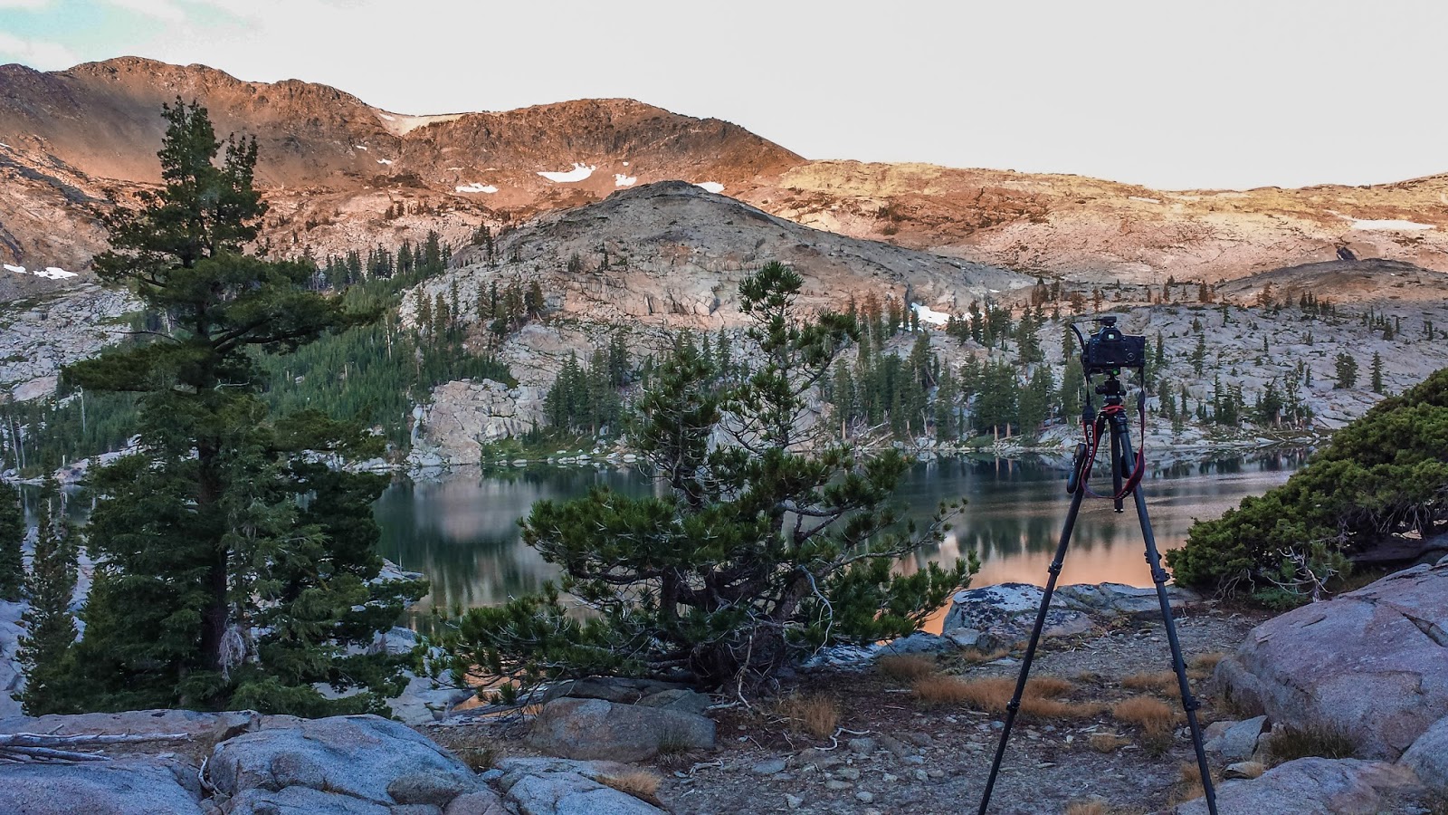
A cell phone picture of my camera.
Day 4: From Dick's Lake to Upper Velma Lake
I saw this cute marmot along the trail to Upper Velma Lake. The marmot scampered away when I spent too much time watching him. It amazing an animal like this can survive the winters up here. Not to mention the coyotes. The elevation around 8,300 feet.
Can you see the trail? When the glaciers melted they dropped whatever rocks they were carrying. The area around Upper Velma Lake is somewhat flat but you can trip and fall if you don't watch your feet.
This is a pond just downstream of Upper Velma Lake. Zoom here.
This is my shower set up. The hanging pocket shower holds a gallon of warm water. (I heat the water with my white gas stove.) I don't like sleeping with a day's sweat and dirt so I gotta have my nightly shower!
Rough cobble all around. There is hardly any top soil.
The sun is setting on Thursday, my last night. Zoom here.
Just before the sun went down the clouds caught these incredible last rays of light. I was listening to Antonio Vivaldi as the sun went down. It still gives me goose bumps watching this magic play out. Zoom here.
I thought the morning was going to be cloudy. I was wrong.....


No comments:
Post a Comment