Click on any image to zoom in....
For the highest resolution images that you can download click here.

The plan was to hike from Yosemite (via Hoover Wilderness) to Lake Tahoe. Unfortunately, I exited the trek at Sonora Pass. Following is my trip report.
I hadn't backpacked in 30 years. Now retired, I found that I could actually get out in the wilderness and enjoy touring the back country of California. Please see the other trip pages on this blog.
I'm also acutely aware of how lucky I am to even consider this kind of expedition. I experienced the death of a friend, Jeff Rogers, (my age) from brain cancer. We also lost our dog, Maggie to lymphoma and a relative was successfully treated for leukemia. I became more sensitive to the wheelchair bound people on the streets of Sacramento. I was determined that if I had the gift of strength and mobility at my age, I was not going to waste it. The idea of an extended hike on the Pacific Crest Trail (PCT) got my attention and would not let go. With the support of my wife, Suzanne, serious planning commenced in March 2014.
I wanted to hike not more than 30 days. Suzanne would drop me off at the Robinson Creek Trailhead west of Twin Lakes, Bridgeport, California. Later she would meet me at Sonora Pass (Highway 108) and Carson Pass (Highway 88) for food resupply. She would pick me up at Emerald Bay in Lake Tahoe. You can see the stats on the above map.
On July 7, 2014, Suzanne, our dogs, and I drove to Bridgeport, CA. We stayed in a little motel on the corner of Highway 395 and Twin Lakes Road. The Redwood Motel accepted pets, was clean but dated. Fine for a road trip.
When we arrived it was in the 90's and humid. There were major thunderheads in the high country to the west. I was nervous about the weather but I was prepared for some rain during this long of a hike. Usually the hot humid conditions pass in a couple of days and everything drys out. That night it rained in Bridgeport.
On the morning of Tuesday, July 8, 2014, it was time to go to the Robinson Creek Trailhead west of Twin Lakes. I was a little emotional when I finished filling my pack's water bladder and loading my pack into the car and told Suzanne I was ready to hit the trail. So many unknowns awaited me on unfamiliar trails on this long hike. And at my age I was worried about my body holding up. But I was ready as I could be. My legs felt like Saturn V rockets ready for lift off. What a feeling!!!!
I was packing a Delorme Satellite GPS beacon and text communicator. When you see dates and times with notes in this blog, those are actual times I posted the notes on the Delorme public website. More detailed notes came from my daily journal that I kept on my smartphone. Here is a link to my public Delorme beacon tracker site:
https://share.delorme.com/ericbost
The weather was clear and cool in the morning. Perfect hiking weather. We couldn't find the trail head parking lot. The dirt roads on the south side of the meadow at Mono Village were not marked. We ended up at the trail as shown on the topo maps. No real parking though. I did eventually find a dirt parking lot about a 1/2 mile down the trail just beyond the south west corner of the big meadow.
FYI --I decided to shave my head again for two reasons: As a bow to Jeff and it simplified staying clean on a long trip.


July 8, 2014, Tuesday Evening, Day 1.
Saw deer, birds, flowers, and about 20 people today. The granite cliffs were inspiring. Felt like a church. Mosquitoes at Barney lake and any where near water were heavy. Thankfully I brought a hat mosquito net. Very spring like conditions. I bet there are less mosquitoes in the fall.
There were nice campsites south of Barney Lake just before crossing Robinson Creek. I went beyond that location since I had an early start. I camped on a knoll half way to Peeler lake. My water is from the outlet of Peeler Lake. There were a couple of crossings of Robinson Creek. Early spring run off of winter snow could make this creek dangerous.
A California Conservation Corp (CCC) crew (15 people, mixed genders) passed me along the way going to a job site at Peeler Lake. They were a friendly group. This is a great program for young people. There are physically intense requirements to participate in the backcountry program: http://www.ccc.ca.gov/work/programs/Backcountry/
Macaroni and chili dinner was good. Still can't get all my food into bear canister. This means I will be sleeping with one eye open and one hand on the boat horn. My shoulders were a little sore, but not too bad.
I’m really doing this! On to Mule Pass (10,400 ft) tomorrow. A big climb.
July 9, 2014 Morning of Day 2:
Woke up at 4 am to the sound of a large animal in the forest. With head lamp and boat horn in hand, I was ready for bear!!!!!
Turned out to be a large deer. Can't believe my hands were shaky. The poor thing lost its footing when I turned the high beams of my headlamp on it.
Jul 09, 07:47 AM On the trail again!!
https://share.delorme.com/ericbost
The weather was clear and cool in the morning. Perfect hiking weather. We couldn't find the trail head parking lot. The dirt roads on the south side of the meadow at Mono Village were not marked. We ended up at the trail as shown on the topo maps. No real parking though. I did eventually find a dirt parking lot about a 1/2 mile down the trail just beyond the south west corner of the big meadow.
FYI --I decided to shave my head again for two reasons: As a bow to Jeff and it simplified staying clean on a long trip.
 |
| View from the meadow at the trail head. |
 |
| Deer on the trail. |
 |
| In two days I will be looking down on this ridge. |
 |
| The terrain is a lot rougher than Google Earth shows. |
 |
| Barney Lake. I will be hiking around the base of the shear rock mountain in the far background tomorrow. |
 |
Barney Lake. Clouds are starting to form. |
 |
| Inlet to Barney Lake |
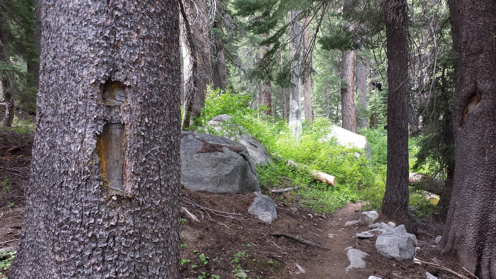 |
| This symbol carved into a tree is a standard trail marker. |
 |
| The trail crossed Robinson Creek twice. Could be dangerous in spring snow runoff. |
Saw deer, birds, flowers, and about 20 people today. The granite cliffs were inspiring. Felt like a church. Mosquitoes at Barney lake and any where near water were heavy. Thankfully I brought a hat mosquito net. Very spring like conditions. I bet there are less mosquitoes in the fall.
There were nice campsites south of Barney Lake just before crossing Robinson Creek. I went beyond that location since I had an early start. I camped on a knoll half way to Peeler lake. My water is from the outlet of Peeler Lake. There were a couple of crossings of Robinson Creek. Early spring run off of winter snow could make this creek dangerous.
A California Conservation Corp (CCC) crew (15 people, mixed genders) passed me along the way going to a job site at Peeler Lake. They were a friendly group. This is a great program for young people. There are physically intense requirements to participate in the backcountry program: http://www.ccc.ca.gov/work/programs/Backcountry/
Macaroni and chili dinner was good. Still can't get all my food into bear canister. This means I will be sleeping with one eye open and one hand on the boat horn. My shoulders were a little sore, but not too bad.
I’m really doing this! On to Mule Pass (10,400 ft) tomorrow. A big climb.
July 9, 2014 Morning of Day 2:
Woke up at 4 am to the sound of a large animal in the forest. With head lamp and boat horn in hand, I was ready for bear!!!!!
Turned out to be a large deer. Can't believe my hands were shaky. The poor thing lost its footing when I turned the high beams of my headlamp on it.
Jul 09, 07:47 AM On the trail again!!


.jpg)


 |
| Crown Lake |
 |
| Crown Lake |

Climbing higher. Mule Pass is up there somewhere!!!

 |
| Thought I was at the pass. FALSE Pass. One more hill to climb. |
 |
| Mule Pass: Note the sign in the distance. |

 |
| Sawtooth Ridge |


Jul 09, 01:01 PM Made it to Mule Pass!!!
Now I need to descend 1,000 ft into the canyon and make camp.
 |
| On the valley floor. Very lush vegetation. You don't see this from Google Earth! |
 |
| This place is so beautiful it still gives me goose bumps. What a privilege to experience this. |


 |
| Watching the sunset. |
Jul 09, Wednesday, 04:07 PM Staying here for the night.
I survived Mule Pass. Only saw 3 people today. The wildflowers were beautiful and helped keep me moving forward one step at a time. The trail up the pass was full of the worst cobble (loose fist sized rocks) I have ever seen. The pass was over 10,400 ft and the lack of oxygen was affecting me. The treadmill workouts were vital preparation, but in no way are they simulations of this climb. I was hurting 3/4 the way up and let my emotions get to me. I saw Jeff circa 2003 in my mind's eye giving me a thumbs up and a high five with that big smile of his. I may be half crazy, but remembering his positive energy and sense of humor made me laugh at my situation and I rebooted and hauled myself to the summit. Thanks Jeff!!!
I didn't get into camp until 4 pm, out of water and very tired. I felt better after taking a shower and having dinner. I had beef stew which was very filling. Didn't taste bad. Not as good as chili mac. Saw lots of birds and squirrels. No bear scat or deer prints on the trail. In the future, I will make sure to camp on the north side of the canyon. It is dryer. The south side of the canyon is still getting snow melt from the north face of the canyon wall.
It is 2 am as I write this. Can't sleep for some reason. I noticed some low clouds in the canyon that make me nervous. I don't need bad weather when I climb Burro Pass tomorrow.
Jul 10, Thursday, 08:06 AM, Day 3
Hitting the trail again. Little slower this morning. Clouds have given way to sun. Heading up Burro Pass then a six mile hike down Matterhorn Canyon.


Jul 10, 10:55 AM On Burro Pass!!! Clouds are building above the ridge.
 |
| Looking South down Matterhorn Canyon |


 |
| I think it is going to rain |

 |
| Looking back at the Sawtooth Range, and rain clouds |
 |
| Matterhorn Canyon Trail. PCT junction is about 1/2 mile ahead. |
| Jul 10, 04:06 PM Stopping here for the night. I should be on the Pacific Crest Trail (PCT) tomorrow morning. Time for some peanuts, ibuprofen, and water. Jul 10, 04:10 PM Saw 3 people and a marmot. Views were incredible on Burro Pass. At noon, some white clouds were forming. In another hour rain was on the pass and was following me down Matterhorn Canyon. When I was leaving the pass a young man was coming up from the south. He said he was going to climb Matterhorn Peak. I saw him again a day later on the PCT. He said the conditions on Matterhorn Peak were something he was not going to tell his mother about. (Rain, thunder, and slick rock faces.) I had Texas teriyaki chicken for dinner and was very good.  |
| Having a hot shower and clean clothes is a wonderful thing. (I wore long johns at night as my clothes dried!) |
 |
| Trying to get camp organized. |
 |
| Matterhorn Creek |
Friday, July 11, Morning, Day 4.
Not sure where these clouds are coming from. It was so humid last night my clothes did not dry and are slightly damp. I don't want to be hit by lightning on Benson Pass so I need to make good time before noon. I'm also concerned about my sore right knee. I'm going to start doing my stretches again in the morning and during the day.
 |
| The junction with my old friend the Pacific Crest Trail |
 |
| My last crossing of Matterhorn Creek on the PCT. I'm glad the winter runoff is done. |
 |
| Wilson Creek: On the way to Benson Pass |
Several nice campsites along Wilson Creek. I would have preferred to camp in this canyon to get an early start on climbing Benson Pass.
 |
| At the summit of Benson Pass. I'm realizing I have travelled some distance. |
Jul 11, 12:18 PM I'm on Benson pass. I can see off in the horizon the saw tooth range. Just had lunch and an going to find a place to camp.
Jul 11, 12:20 PM My REI outer garments dried in about an hour. Socks and under wear should be dry in another hour.  |
| On Benson Pass looking northward on the PCT. |

 |
| I have never seen such large granite crystals. |

 |
| Smedberg Lake. Was going to camp here, but wanted to cover more distance. |

Jul 11, 04:40 PM Made it to within a couple of miles of Benson Lake. Found a high and dry spot with not too many mosquitoes.
The trail from Smedberg Lake to this point was in bad shape due to horses/mules tearing up cobble on very steep trails. Very slow going to hike on, even going down hill. I really don't see how trail crews can maintain the trails with 1,000 lb animals using them. Not to mention the manure problems. Seems like the poor animals poop at the base of every steep trail in poor condition. I guess I would too if I was a horse. I wonder how many pack animals are injured each year on this trail?
Jul 11, 09:29 PM: I made some good time today. I saw 10 people. One Brit, 5 Germans, 4 Americans. The PCT seems to be popular with Europeans.
Jul 11, 09:34 PM: The thunder clouds seem to be staying east of my location. Lots of blue sky. I had a large pot of chili that was very good. I'm ready to crash.
Day 5
Saturday, Jul 12, 06:40 AM: Blue skies this morning. I have to ford a stream 2 miles ahead. Then climb up to Seavey Pass then down again and another stream ford.
Jul 12, 06:42 AM Knees are feeling OK as long as I keep taking ibuprofen at night. I've been using too much soap with my nightly shower so the soap and ibuprofen are now carefully rationed.
Jul 12, 07:48 AM On the trail again...
It was about an 30 minute hike to the Piute Creek near the Benson Lake Trail Junction. This is the same creek as in the Sawtooth Ridge Canyon. Just more water in it. I had to take my boots off and wear my camp shoes for the crossing. I could see how this could be a treacherous crossing with large snow melt or thunderstorm flash flooding. Heavy mosquito action here.
After this crossing, the PCT proceeds to climb about 1,400 ft to Seavey Pass. A small climb compared to Mule, Burro, and Benson Pass. I just let my lizard brain do the walking and managing the trekking poles and let my higher brain go into day dream or photographer mode.


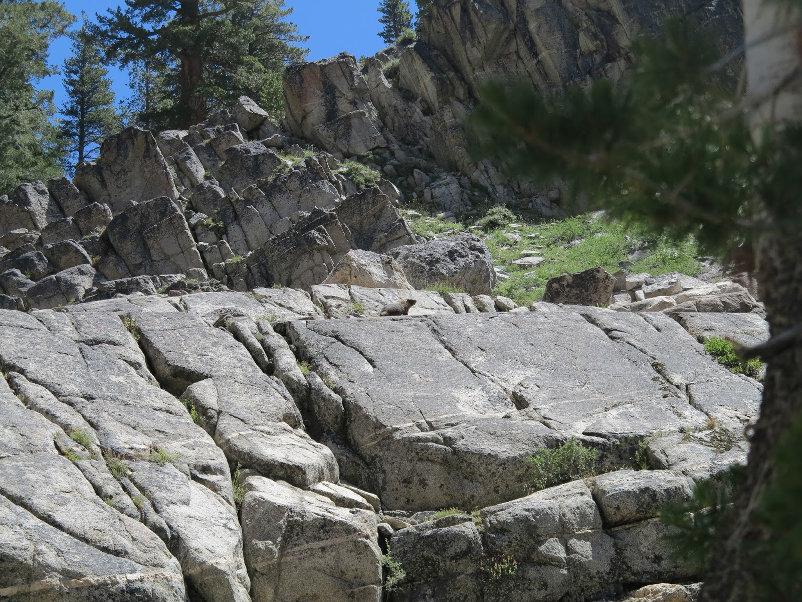 |
| See the cute Marmot? They were leaving raccoon like foot prints on the trail. |
Now that I am hiking north I see my shadow a lot:

 |
| What a beautiful stair that someone built. Someone cared about the quality of their work. |
 |
| Very rough terrain if you need to hike down to the water. |
Today, Saturday, July 12, I hiked over nine miles. My knees are feeling better since I started stretching. I don't need ibuprofen anymore.
 |
| Dusk at Kerrick Creek Crossing |
Someone left a pen on the stump. I imagined that someone is upset about not being able to maintain their journal. When there is no one to talk to, writing a journal can be entertaining.
My mind seems to be fixated about how the brain's low level motor functions (lizard brain) can magically place one's feet in just the right spot on difficult cobbled trails. Same thing with the trekking poles. Ninety nine percent of the time my lizard brain can place the tips of my trekking poles in just the right place to help me climb rock steps or help brake a steep descent. It is miraculous. As I hike I'm not consciously thinking about how I place my feet or plant the tips of my trekking poles. I took a hot shower and did some laundry. I'm feeling pretty good. Turkey tetrazzinni dinner was excellent. I mixed in some home dehydrated tomatoes from last year's garden for extra flavor.
Jul 12, 09:55 PM The sky is so clear tonight I'm not putting on the rain fly. I'm also happy that my knees are feeling better even though I hiked over nine miles.
Jul 12, 10:05 PM Today I saw this man and woman going off trail down to the stream. It looked like they were trying to get water. They were scaling car sized boulders to get down a 100 ft steep embankment to get down to the river. They probably blew an hour trying to get a liter of water, not to mention putting themselves at risk slipping and falling from a boulder.
Jul 12, 10:10 PM I carry 2 liters of water starting in the morning. It is heavy but if you run out of water, sometimes good judgement can be compromised. Jul 12, 10:18 PM I'm happy I'm now hiking north because the sun for the most part is on my back. It is much cooler since my pack is shading me.
Sunday morning, July 13, Day 6 I dropped my satellite communicator. My phone will no longer link to it. The communicator says the device is damaged and to return to manufacturer for repair. I seem to be able to send and receive messages but I don't know if my location is being tracked. Jul 13, 07:38 AM I am on the trail again hoping to make it to Wilma Lake.


I decided to reboot my satellite communicator since I turn it off at night anyway. My satellite communicator started working normally. What a relief. I also noticed old bear scat around camp. I'll have my boat horn at the ready. My trail name is Bear Horn. (Check out the link on trail names. This person also has some thoughts about PCT through hikers integrating back into civilization.) I talked to 4 young women who just graduated from college hiking together the entire PCT. They wanted to do something memorable before they had to go home and look for a job. They were addressing each other in trail names. I told them I was packing a US Coast Guard approved boat horn for boats up to 65 feet to scare off bears. So I thought my trail name should be Bear Horn! I know it is not the rules to name yourself, but it is a good trail name. As a solo hiker, you kinda need to bend the rules. It seems the shared struggle of climbing these high passes, surviving mosquito swarms, and limited water and food supplies gives people commonality. Real names fall away and the trail names matter.
They laughed and agreed that was a fantastic trail name. Since they had trail names they could officially approve mine. Interesting group. Being recent graduates, they were struggling with the prospect of becoming office zombies to make their way through life comfortably. Every generation faces the same challenging questions. Frankly, I think all jobs require some level of zombie like behavior to survive. I avoided fatherly advice because they needed to find themselves on their own. I felt like advising them to focus on the moment because in 30 years they would have trouble remembering this adventure. (I can barely remember the details of the Tahoe - Yosemite Trail hike I did in 1978.) I think the one of the biggest differences between now and 1978 is now the gender of the hikers is about 60/40 men/women. In the old days it was more 98/2. It still surprises me to see solo women hikers. Eric, welcome to 2014!!!
The trail provides lots of time for introspection and mental rambling. The trail teaches you to be flexible. So much is out of your control. The trail also teaches humility, patience, how to endure physical pain, to grunt, willfulness and camaraderie. But the trail won't make you normal. Ever. Forget about it. It won't make a boring office cubicle job or physically intense construction work any easier but it will open your mind to better problem solving. I think the dynamics of the trail gives you lots of practice to consider all options, forces you to make decisions in a timely manner and to live (or die) with the result of those decisions. Another observation: Except for the CCC group, all of the people I encountered on the PCT were Caucasian. I've seen one black man and I think a Filipino woman in Desolation Wilderness last year. I wonder what the dynamics are that cause this? Large segments of our population are missing out on knowing about the amazing trail networks in the high country.
Monday, Jul 14, 07:18 AM, Day 7: I'm starting my hike now. It appears my satellite communication issues have been resolved. I think Delorme saw the issue and fixed a software problem remotely. With my new trail name I'm ready to log some miles! Really tired of the mosquitoes here at Wilma Lake. I should have put DEET on in the morning, but wanted to get moving. See this video:
As I was leaving Wilma Lake there were some nice campsites on the west side of the lake near Falls Creek. Water access is from a creek rather than the swampy lake. Still lots of mosquitoes. Water access is much better from the creeks than lakes.
Jul 14, 02:03 PM Stopping here.

Jul 14, 02:03 PM Stopping here.
It rained and thundered for about 20 minutes after taking these pictures. No swarms of mosquitoes here. I'm near a nice creek.
Jul 14, 02:10 PM After reviewing the maps, I am pleased to say the most difficult climbing and descending are done.
Jul 14, 06:04 PM Thunder was very heavy in the afternoon making Sonora Pass too dangerous to cross except in the morning. It is about a 7 mile ridge that is very exposed.
Jul 14, 06:13 PM I have very little patience playing cat and mouse with lightning storms in the high Sierras. And I'm the mouse who has everything to lose.
Jul 14, 06:19 PM So, if my safety is compromised, I will consider this section hike complete at Sonora Pass and come home.
Jul 14, 07:06 PM I had a big pot of spaghetti for dinner and a fudge clif bar for dessert. YUM. It is raining again. Temp is about 45. I'd like a glass of wine please.
Tuesday, Jul 15, 06:29 AM, Day 8 Just had an oatmeal breakfast. Some high clouds. I need to break camp and hit the trail. I need to get over Dorthy Pass before the weather sets in.


 |
| Dorthy Lake |
 |
| The famous post mile 1,000 on the PCT. Nice campsites here along a creek. |
 |
| I took this picture at 12:08. In about an hour the weather would turn violent. |
Jul 15, 02:54 PM Six sec between flash and thunder!!!!!
Jul 15, 03:00 PM Main head seems to now be moving away. So noisy!!! Now 10 sec delay.
Jul 15, 03:03 PM Now 12. I think I survived. Still raining. Killing mosquitos in tent to keep busy!!!!
Jul 15, 03:06 PM Quieting down. Still raining. Thunder at least 30 sec away now.
Jul 15, 03:11 PM Myy hhaanddss aarree sshhaakkiinngg!!
Jul 15, 03:12 PM Back to 6 sec delay!!!
Jul 15, 03:16 PM Now 10 sec. Very slow moving storm.
Jul 15, 03:19 PM 20 sec delay.
Jul 15, 03:21 PM I love my wife and this tent.
Jul 15, 03:28 PM The storm is winding down. It started out so nice. It fell apart within 20 min around 1 pm. It turned violent so quickly.
Jul 15, 03:50 PM And I love my doggies too.
Jul 15, 05:09 PM I rigged up a suspension of cords to dry my clothes in the tent. I am warm and dry. I have a liter of clean water in my pack bladder to make dinner.
Jul 15, 05:12 PM Water might be a problem tomorrow morning. The river is loaded with silt. It will clog up my filter quickly. I can field clean it but it's a lot of work.
Jul 15, 05:35 PM The rain just stopped and I hear birds tweeting.
Jul 15, 06:01 PM I just heard a very low flying helicopter. I wonder if someone got hurt up here?
Jul 15, 07:53 PM Raining again but no thunder. Had beef potato stew with all spice. The rain held back just long enough for me to boil water, cook it and eat it.
Jul 15, 08:00 PM This morning I saw 4 people hiking into Dorthy Lake. 30 minutes ago I saw one guy and waved hi. He had a big pack on and was limping. He didn't want to stop.
Here is a video of me in the tent whent the lightning was blasting away around me. I again assumed the crouch position in the tent, feet together so I would not get eletrocuted by secondary ground currents. See this for lightning safety information. Also see this about a PCT lighting incident in 2012.
You may see me smirk in the video below. I was in the crouch postion waiting for whatever was going to happen. I was thinking about, "what a way to go." I always thought I would be an old man having a heart attack pushing my lawn mower.
 |
| I pitched my tent accross the bridge on the right. Thank God there was a bridge. I didn't want to ford this river. |
 |
| During the storm, I past the time by rigging up cords to dry my clothes. Worked good. Smelled bad. |
 |
| I'm still here!!!! Love that hat! Thanks Floris! |
Jul 16, 07:39 AM, Day 9 Blue skies to the north, high clouds south with dark underbellies. When will this weather break? Jul 16, 09:11 AM Blue skies seem to be pushing back the clouds. I'm joyful.
Jul 16, 09:16 AM Starting short hike to today. I don't want to be on any high passes in the afternoon. Today I can easily make Kennedy Canyon and have time to clean up.
Jul 16, 09:16 AM Starting short hike to today. I don't want to be on any high passes in the afternoon. Today I can easily make Kennedy Canyon and have time to clean up.
Jul 16, 11:54 AM Made it to Kennedy Canyon. Blue sky is losing to clouds so I need to prepare for rain and try to dry out what I can. It is very humid. A lot of cow pies here! Why does the cattle industry think they have the right to filth up this pristine area????? I've doubled up on the chlorine dioxide water treatments.
Jul 16, 08:27 PM Did some laundry between rain showers. Hope it dries by the morning. It rained from about 1:30 until 6:30. Much thunder on Sonora Crest. When the rain stopped I made dinner.
Jul 16, 08:30 PM This location is the start for climbing the Crest and then hiking about 7.2 miles. There is no water on the Crest. The elevation is over 10,000 ft.
Jul 16, 08:36 PM About 6 other PCT hikers made camp in the last 2 hrs. Everyone is pretty much hunkered down in their tents.
Jul 16, 08:39 PM I really enjoyed the chilli dinner tonight.
Jul 17, 07:45 AM, Day 10 Starting up the climb to the Sonora Crest. It is already cloudy. Nothing dried out last night. I tied my tent's rain fly to my pack hoping it will dry in today's hike.
 |
| Everything wet is strapped on the exterior of the pack. |
 |
| Almost to the first saddle. I will be climbing to the highest ridges. |
 |
| One step at a time. Lizard brain working the arms and legs. Higher brain performing weather risk calculations. |
 |
| Keep climbing. You can see the trail way off in the distance. |
 |
| Climb Climb Climb |
 |
| Clouds to the far south. It is 9:51 am |
 |
| Breath taking views looking southwest. |

 |
| Beautiful!!! Time is 10:25 am. More clouds. |


 |
| The PCT goes through the tiny key hole through the rock on horizon on the left. Zoom in and you can see the trail. |
 |
| Approaching the key hole. Very little blue sky left. |
 |
| The key hole is just around the corner. Then a decent to Highway 108 and out of harms way. |
 |
| One final look behind my shoulder. Incredible views. PCT is in foreground. I wish I had blue skies. |
 |
| The key hole was a false pass. The clouds were now starting to look menacing. I was in trouble. I had another pass to cross. |
 |
| Fooled again. Another false pass. If you zoom in you can the PCT. |
I could no longer take photos because of the intensity of the rain. The true last pass came into view and I felt like I was suckered punched. It was a barren saddle with a wood post stuck in it declaring no campfires permitted above 9,000 ft. The continuous strobes and explosions of thunder was beyond anything I have experienced before.
Lizard brain was controlling my arms and legs -- full power with no pain and I didn't feel the cold even though I was soaked. As I crossed the saddle I was crouching keeping my profile as low as could. I looked north to Lake Tahoe and saw nothing but the worst summer weather I had ever seen. I was so happy to start the 1,000 ft descent to Highway 108.
With the heavy downpour I was starting to see small gravel mud flows. In some areas the trail was turning into rivulets. The more I descended the more concerned I was about falling rocks from the ridge and land slides. The face of the mountain was filled with table and car sized boulders waiting for the right moment to come down and surprise me. This side of the mountain had clay soil. Water was going to turn the clay into a lubricant. With each blast of thunder I could just see the boulders get more anxious to do what boulders do.
Lizard brain was doing just fine. Steady gait, steady poles, forded two flooding rivulets. Motating. Good lizard brain. Good. As I approached Highway 108, one PCT through hiker left a note in a baggy (in trail names) that they were getting off the trail and heading to Kennedy Meadows to take a break and resupply and invited another hiker to join them. Kennedy Meadows is about 6 miles west of Sonora Pass. Smart hiker. Walking on the pavement of Highway 108 was an odd sensation. Back to civilization.
Back to the plan. Suzanne was on her way to Walker, California to spend the night. Tomorrow morning we would meet at the summit for my resupply. I was going to spend the night about 2 miles south of the summit on the side of the highway. (I'm not proud!)
Jul 17, 03:33 PM I'm on Hwy 108. It was not safe. Hail, rain, and lightning dogged me. With the threat of a lightning strike, I did not stop to put a rain jacket.
Jul 17, 03:37 PM I also didn't have time cover my pack. My gear has been wet for about 4 days. The mornings are beautiful, but with rain setting in at 1 pm nothing dries.
Jul 17, 03:42 PM Because of the rain, I have not had a shower in 3 days. Rubbing alcohol and a towel can do miracles in a pinch. But there are limits.
Jul 17, 03:45 PM The views were spectacular from the Sonora Crest. The thunder heads would appear like the clouds out of Close Encounters of the Third Kind.
Jul 17, 03:46 PM HERE THEY COME AGAIN!!!
Jul 17, 03:52 PM I am currently warm and dry in my sleeping bag in my tent. I'm camped off the state R/W so CHP should not bother me. I'm on federal property with a permit.
Jul 17, 03:54 PM I'm hoping the rain will let up so I can cook up a pot of stew and set up a clothes line.
 |
| Camped on the side of Highway 108 in the rain. Caltrans plow in the background. Pathetic? |
For 2 minutes I considered my options. If I said yes, I would be tempted to terminate the hike. If I terminated the hike, would I be a wimp? I was frustrated because after the last 70 miles, I was fit and strong as steel to finish this hike. On the other hand, this trip was no longer about touring, but dealing with lightning and rain. I didn't even get a chance to use my bear horn! I'm getting another life lesson in humility and common sense.
I replied, Jul 17, 04:47 PM "Yes, thank you."
I figured I could dry things out tonight in the motel and do some laundry and take a hot shower. I would defer a decision until the morning.
When Suzanne pulled up in the minivan, I knew instantly that I wanted to terminate this hike. The danger was not worth it. In a few weeks these monsoonal air masses would go away. I could always restart the hike later. Yep.
Jul 17, 07:23 PM My Trail Angel has saved me. Again and forever. That evening I made the decision not to go back on the trail. The weather forecast indicated severe afternoon thunderstorms for at least another week. I am sad. I'm also thinking about this year's PCT through hikers that have no choice to keep hiking in these conditions if they want to get to the Canadian border before the fall snow. I worry about their safety but I also admire their determination. Whether the risk is worth it is an individual decision. There is no right or wrong answer.

Hikes for 2015: All the PCT hikers said the best part of the trail so far had been the segment where the John Muir Trail coincides with the PCT. I'd also like to spend a week back in the Hoover Wilderness and Saw Tooth Ridge and attempt some fine art photography.
Regarding my transition back to civilization: Reading news about the ISIS, Iraq, ML-17, the Gaza, ebola, and all the local news is difficult. Memories of the Saw Tooth Ridge and the PCT are a welcome and healthy distraction. The PCT pulls at me hard. I keep thinking about it and thinking about it. I'm going to tell my neighbors when I am a very old man that if they see me wandering around the neighborhood carrying my little orange trowel with a roll of toilet paper in a big baggy, that it will be time to put me in a memory care unit in the Carlton Retirement Community. Until I'm on the trail again....
No comments:
Post a Comment