Daylight is Burning and Summer is Almost Over!!!
Hard to believe this is still about the John Muir Trail. After the Phipps Pass hike I trimmed the weight of my pack down by only carrying 10 days of food rather than 16. For the JMT, this means I would need a food resupply at the Onion Valley Trailhead to support a north bound hike starting at the Horseshoe Meadow campground. This hike was another test of what I would be comfortable with on a long hike.
I decided to keep packing the heavy DSLR camera. Some images below have links to high definition jpgs. If you have a large screen, you will see why I like the DSLR camera.
This hike started on Thursday, August 20, 2015, with the intention of being out for 10 nights. I would start at the Echo Lake Trailhead and follow the Pacific Crest Trail to Middle Velma Lake and cut west to Camper Flat. From there I'd head south along the Rubicon Trail back to Echo Lake, visiting as many lakes as I could within 10 days.
Note: Most of the hiking videos have surprises. Have a little patience before clicking out of them...
Day 1: One step at time!
 |
| At the Echo Lake Trailhead. This '93 Subaru may have 170K on it and a failing paint job, but makes an excellent trailhead car. There are so many other nicer cars in the parking lot so I don't have to worry too much about my car getting stolen. |
 |
| Looking north to where the boat taxi takes people to the entrance of Desolation Wilderness. Saves walking about 2 miles. It is a beautiful morning so I chose to hike along the Pacific Crest Trail (PCT) and enjoy the views. |
 |
| The PCT crosses the dam. Note the plaque on the granite to the right. |
 |
| Clyde and wife lost their lives in this lake in 1932. Echo Lake is about 300 ft deep. Why no name for the wife? (sexism?) Was Clyde Lake named after this man? |
 |
| Walking north... |
 |
| I just want to drink in the blue water and sky... Here for hi def image. |
 |
| Upper Echo Lake |
 |
| Just a great day! |
 |
| Still a few flowers in August in a drought year! |
Spending the night at Lake Lucille. From here I could see the casinos at South Lake Tahoe. I had a Verizon 4G signal here so I recorded a little shout out to Chloe who was experiencing her first day at college and posted on Facebook...
 |
| A good day to be a duck! |
 |
| Enjoying Sunset at Lake Lucille (High def) |
Day2: On to Suzie Lake
 |
| Back on the PCT to Lake Aloha |
 |
| A little smoke in Desolation Valley from the fires down south. |
 |
| Heather Lake. Lots of smoke. |
 |
| Approaching Suzie Lake |
Day 3: On to Dick's Lake.
 |
| Sunrise at Suzie Lake. The golden light is from the sun shining through the smoke to the east. (Click for high def) |
 |
| Suzie Lake with sun up past the smoke. Time to start hiking! |
 |
| Just follow the arrow with the PCT logo! |
 |
| On to Dick's Pass. (I love trail markers!) |
 |
| My last view of Pyramid Peak for awhile. |
 |
| Ahhh, my two brothers. Jack and Dick's Peak. Half Moon Lake in the foreground. (High res) |
 |
| On the PCT. Head straight for Dick's Pass. |
 |
| Saw this jewel near the top of the pass! |
 |
| Cirsium andersonii (Anderson's or Rose thistle.) Native to California in the high mountain ranges. A native thistle. (High Res Image) |
 |
| This is what you see on the saddle between Dick's Peak and the actual Dick's Pass. The pass is another 1/4 mile along this ridge. (High res) |
 |
| My favorite camping area at Dick's Lake. (High res) |
 |
| This is the sunny side of Dick's Lake. Camp on this side when it is cold. (High res) |
 |
| The final climb to Dick's Pass! |
 |
| At the top! Note the new marker. Wonder what they do with the old markers? |
 |
| On the north face of the Dick's Pass are lots of Christmas trees! |
 |
| Very Yosemite like terrain on this side of Dick's Pass. (granite) |
 |
| After three days of hiking everything needs washing. I was 300+ feet from Dick's Lake so I had lots of privacy. Modern synthetic hiking clothes usually dry within 2 hrs in the summer. Tired but clean! Daytime temps were in the high 70's. Quite warm with the heat also reflecting off the granite. Nights were in the low 50s. |
Day 4: On to Middle Velma Lake and Camper Flat.
 |
| Early morning at Dick's Lake |
 |
| Another early morning shot of Dick's Lake and Dick's Peak (High res) |
 |
| Back on the PCT! The Bay view trail is also a great hike. |
 |
| Fontanillis Lake with Dick's Peak in background (High res) |
 |
| Another view of Fontallis Lake (High res) |
Interesting conversation about the bear at Middle Velma Lake. I was there.
See this blog page. I left some information out of that blog entry but the man's comments make me want to tell the complete story. The bear first came around 5 pm which I discussed. At around 3 in the morning I heard a man scream in fear twice (this was a terrify sound) and then blow his emergency whistle twice.
I was waiting for a third blow on the whistle which would mean an emergency situation was occurring. I was getting ready to suit up, retrieve my first aid kit, power up the Delorme InReach and verify my cell phone was still connecting to Verizon. My heart was racing.
Then I heard someone yell out that they were ok.
People have got to learn to NOT keep food and other scented toiletries in their backpacks at night. In Desolation Wilderness these items must be hung (counter balance method) in a bag or placed in a bear canister. Snack foods for eating along the trail should be kept in a LOKSAK/OPSAK so the backpack does not take on the smell of any food. Cooking should be done away from one's tent so the bears stay away.
No fishing either. This is chumming for bears. The fish smell gets on your clothes and gear and cooking fish is like clanging a bell for bears in the area to "come and get it!" Burying the entrails does no good because the bears will find it and make a mess. Don't mess with the bear's senses and they won't mess with you. A bear's sense of smell is over 1,000 times more sensitive than a blood hound.
I have never been bothered by bears!
Okay, enough lecturing.
Onto Camper Flat and the Rubicon River...
 |
| We don't want to go to Phipps Pass!!! |
 |
| This is our exit off the PCT! Now heading west! The trail is on the left. |
 |
| Weird tree hanging over the trail. Catapult gone wrong? |
 |
| In bear country! Note the berries in the scat. |
 |
| This is how trails are marked across granite slabs. |
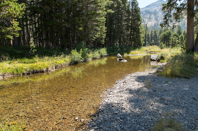
At this point the trail descends rapidly into the Rubicon Valley. The elevation was in the low 7000 feet, the granite was radiating heat and it was hot. I was consuming more water than I usually do. Everything was so dry. No birds in the forest. Something didn't feel right. I prayed there was water in the Rubicon River.
As I approached the bushes surrounding the river it was eerily silent. I don't pray that often, but I did then for fresh water. Also, since I had left the PCT I had not met anyone on the trail. Footprints on the trail were not fresh either. Could lack of water be the reason?
 |
| The Rubicon was dry and I had about of pint of water left. |
The worst case scenario was I would need to treat stagnant water. It was in the mid 80's. Kind of hot for carrying a 45 or 50 lb pack. I decided to hike north towards Camper Flat to see if the outlet stream of Lake Schmidell had water.
I came to an area where camping on level ground might be a possibility. I needed to rest. The heat was making me irritable. I hiked about 500 ft off trail and followed the dry river bed. (no trail) I kept telling myself to stay calm and I still had a pint of water to get me through the night. Then... Then...
 |
| Thank you God for the sweet water!! |
 |
| Bear food along the Rubicon River bank. |
Day 5: Decision in the morning!
I did some more scouting around and found the outlet to Schmidell Lake not far from where I was camped. It was dry so I decided to move on to Clyde Lake where I knew there would be water. Bummer. I really wanted to spend a night up there.
 |
| Saw this on the map and found this by the side of the trail. I had this vision of soaking in hot springs. |
 |
| This is the mineral spring. Movin on... |
 |
| More bear food |
Hiking up the Rubicon Valley was a very different experience than on the PCT. In many cases I was hiking through bushes taller than 6 ft. I clacked my trekking poles together many times to give bears plenty of warning that a human was in the area. I was also thankful that I was wearing long pants. This was a good place to pickup ticks because the bushes were growing into the trail. I had not seen anyone in 24 hrs which was unusual for Desolation Wilderness in August.
I came across the outlet to Lois Lake which to my surprise had plenty of water. I missed out on visiting Lois Lake.
 |
| Lois Lake outlet as it crosses the Rubicon Trail |
I debated about posting this video. For me at least, after day 3 of a hike I change. I eat more. I love the flavor of olive oil mixed in with rehydrated freeze dried food. Dirt doesn't bother me as much and I talk to myself and sing. This video shows how the Rubicon Trail is so much more different than the PCT.
 |
| So sad to see the Rubicon River in this condition. |
 |
| This trail heads west to Wrights Lake. I need to keep heading south. |
 |
| The mighty Rubicon vanquished by the drought of 2015! |
 |
| Yet still enough moisture for flowers in August! (High res) |
As I continued my hike south up the Rubicon I noticed a small pond west of the trail barely visible through the trees. It looked nice so I hiked off trail about 400 feet and came to some nice campsites along this small pond. Something about this looked artificial. The water was clear but had a amber tone reflecting the color of the bottom....
 |
| A special tarn on the Rubicon River! (High Res) |
 |
| A beaver dam!!! |
 |
| So nice!! |
 |
| A beautiful open meadow. Maybe eons ago created by beavers? (High res) |
 |
| The Rubicon is starting to get more water in it! (High res) |
 |
| I inhale these views. A route to climb Mt. Price in background? (High res) |
 |
| And the trail to Clyde Lake.. |
From my topo maps and from the Google sat images, Clyde Lake seems similar to Dick's Lake. There should be lots of treed flat areas with nice camp sites, boulders and beautiful carved granite slabs that meet the water. I really love looking at the texture of how water meets granite. I have food for two or three days to stay here and explore.
 |
| The water is as clear as anything I have ever seen. But... |
 |
| I can just see the glacier that was here carving the granite! (High res) |
 |
| But there were nothing but boulders around this lake! (High res) |
I hiked the entire perimeter of the lake that was not against the mountains. There were some very exposed spots that I could barely pitch my one person tent on but there would be no protection from the sun, wind, or thunderstorms, if they came up. In fact I think it would be dangerous to camp on the knolls because you would have an elevated risk of being hit by lightning.
The poor campsite options surprised me because there were a man made dams on this lake and the workers needed to camp somewhere. I could not find where they likely camped. This is the headwaters of the Rubicon River so maybe I needed to follow the dry channel a mile to find it. I was exhausted from rock hopping with a 45lb pack so I found a spot to camp under some trees on a steep hill. Gorgeous but rough wilderness area!
I was sad to see that other campers that camped among the boulders defecated between the boulders and left soiled toilet paper. I understand that there was no topsoil to bury the waste, but they could have packed it out of the basin and buried the waste elsewhere. After a good rain or during the spring snow melt, I would advise future visitors to be vigilant about water purification. Fed regs require that all toilet paper be packed out. Sadly, some backpackers ignore the regs and foul the environment for the rest of us.
Day 6: Trapped!!!
I felt claustrophobic at Clyde Lake because it was so hard to get around. Topos and Google sat images could not show how all these boulders would hinder free movement.
I decided to bug out!
 |
| Sunrise at Clyde Lake. Sun is shining through smoke haze. (High res) |
Time to hike out...
 |
| My legs are like Saturn V rockets powering out of the gravity well of Clyde Lake. Beautiful morning! (High Res) |
 |
| Looking back north into the Rubicon Valley. (High res) |
 |
| On the top of Mosquito Pass. Note the dry tarn to the left of the trail. That is where the mosquitos must be in the spring. I bet it can be dense with bugs there. |
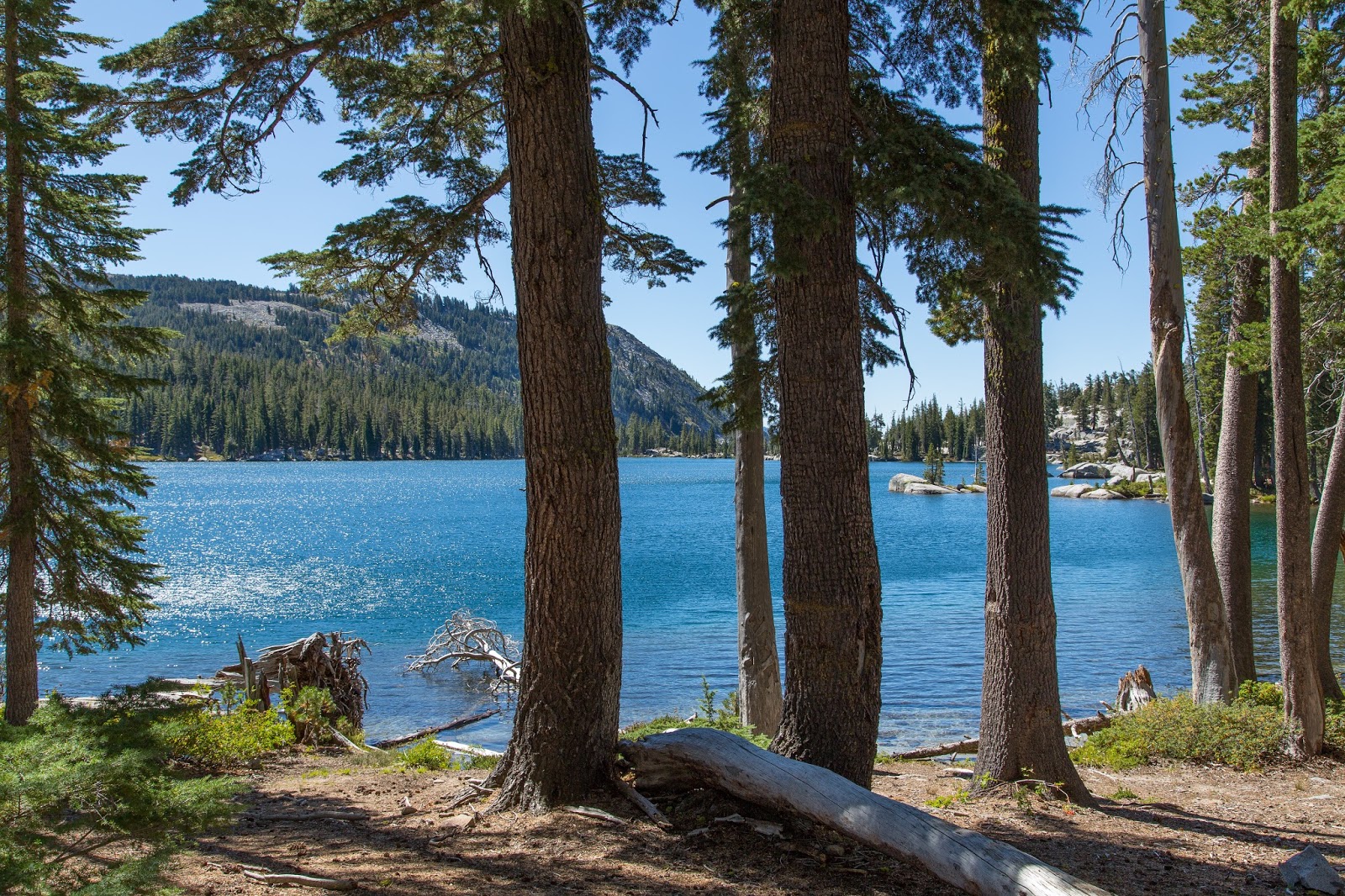
Now looking south is the crown jewel of Desolation Wilderness: Desolation Valley which includes the mighty Lake Aloha and hundreds of other lakes. Gives me goose bumps reliving these views.
 |
| The PCT is along the east shore. (High res) |
 |
| Nice camp area there, but I will be on the other side of the lake. |
 |
| Pyramid Peak is back in view! (High res) |
Here comes sunset...
 |
| Watch what happens to the clouds... (High res) |
Day 7
And now for some sunrise shots:
 |
| At sunrise there was a band of clouds that created this unique lighting. (High res) |
 |
| Watching the sun lighting up Lake Aloha foot by foot. (High res) |
 |
| This is where I camped at Lake Aloha. (High res) |
There were a lot of people up at this end of Desolation Wilderness. I decided I would go home today even though I had 4 more days worth of food. I also wanted to process Claire's shout out before she went to college.
First stop would be Lake of the Woods. I found an unmaintained/unmarked trail that lands you on the west side of Lake of the Woods. Really nice hike. From there you can get back on the main trail back to Echo Lake.
 |
| Lake of the Woods with Pyramid Peak in the background (High Res) |
 |
| On the way to Upper Echo Lake... |
 |
| Tamarack Lake. It is about 15 min off the main trail. Had lunch there. (High res) |
 |
| Upper and Lower Echo Lakes coming into view. I'm getting that weird feeling that happens when you come off the trail. (High res) |
 |
| Getting closer. Car is parked at the far end of the furthest lake. (High res) |
 |
| I like how this rock leans over the PCT (High res) |
And the final video! Enjoy!!!


Loved your sharing of beautiful photos and videos. They brought back great memories of my first backpack trip with my brother up to Suzie and Aloha Lakes and climb to the top of Tamarack Peak, about 40 years ago, and a snow course with Ned Tibbiits/Mountain Education in Desolation Wilderness above the Echo Lakes just a few years ago! Fabulous area and thank you for inspiring a new desire to return!
ReplyDeleteThanks! In my late teens and 20's I backpacked extensively in the Tahoe region. Fell out of it for decades. Got back to it when I retired and lost a friend to brain cancer. Makes me feel so alive being up there. I actually noticed how the trees had grown in certain areas since the 80s and 90's. It is good to know the mountains are always there for us!
Delete