"Not all those who wander are lost"
(J. R. R. Tolkien)
Mokelumne Wilderness: Carson Pass - Fourth of July Lake - PCT Loop, Alpine County, July 16-18, 2013
I have found myself drawn to the trail again. I haven't backpacked in 20 years. Why am I doing this?
The answer is on a lot of different levels. But, I'll keep it simple here: I love the scenery. It makes me happy.
Rocks, dirt, wild critters, clean water, trees, flowers, the weather, the Moon, and stars. Clean, nutritious food. Health. Some sort of connection with God. The wilderness experience underscores and brings focus to these issues. I like the challenges.
Please enjoy this journey with me.
This is a two night loop trip from Carson Pass off Highway 88 in California to Fourth of July Lake to the Pacific Crest Trail and back to Carson Pass. The trip was from July 16, 2013 through July 18th.
To see larger images, just click on them.
First day:
Below, I'm approaching Winnemucca Lake. The flowers were in bloom! Early to mid July are the best time to see the wild flowers.
Round Top Peak is on the left.
Where there is water there is color. This is past Winnemucca Lake. (The lighting was not good for Winnemucca Lake and I didn't have time to walk to the far side. Winnemucca is best photographed in the evening.)
Round Top Lake. Pretty windy there.
Approaching the pass that descends to Fourth of July Lake.
Here is a video. It is windy so turn down your speakers.
Another view of the pass. Kirkwood ski resort is to the right.
A tough beautiful flower.
About ready for the drop down to Fourth of July Lake.
Very rugged terrain.
First glimpse of Fourth of July Lake. Losing lots of elevation. Having two hiking canes has really helped with taking the shock off the knees and provides amazing control on this steep descent. (See the trail map above.)
Fourth of July Lake sits in a pocket between two peaks. About 50 yards beyond the lake is another major descent into Summit City Canyon.
Lots of flowers on this side of the mountain.
Getting closer to first camp.
Looking at the mountains on the other side of Summit City Canyon.
Can you tell I like taking pictures of this lake?
Looking back up the pass.
The scale of this terrain is incredible. Fourth of July Lake is on the left.
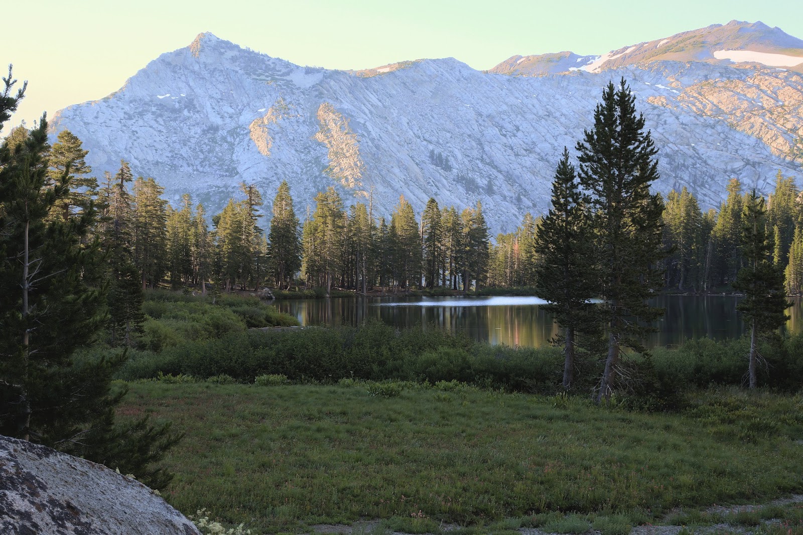
This is the Wednesday morning sunrise.
Another sunrise shot. The mountains in the background are on the other side of the canyon. Just beyond the lake is a big drop to the canyon floor.
Another view of Fourth of July Lake.
Here is a map of the day 2 hike:
And the big drop into the Canyon starts...
On the trail descending to the canyon floor.
This trail does not get much use. Who would be crazy enough to desend to the canyon floor and then climb 1,500 feet back up to the Pacific Crest Trail (PCT)?
Views of Summit City Canyon
Looking back to the saddle where Fourth of July Lake sits.
Nice camp area. I did not spend the night here but refilled my water supply for the climb up to the PCT.
Lots of big rocks!
A shady rest stop.
Where is the trail?
Where is the trail????? (It was so overgrown I had to use my hiking canes to move the brush out of the way.)
Gaining some serious elevation....
Where there is water there is green.
Finally back on the PCT. It is windy, so turn down your speakers again.
This is a no name pond. Good water. I camped on a knoll nearby.
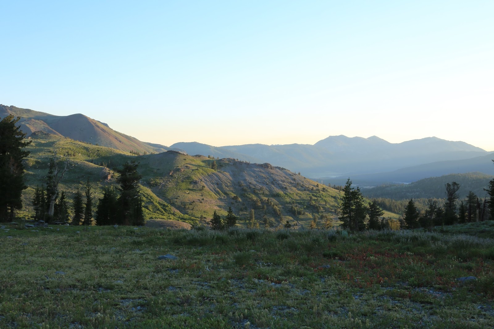
Sunrise, Thursday, July 19, 2013. The color variations as the sun rises is amazing.
Amazing how these little flowers can hibernate over the deep freeze of winter.
Flowers doing what they do best.
These tree branches remind me of how fickle the wind can be here. The wind seems to come from every direction.
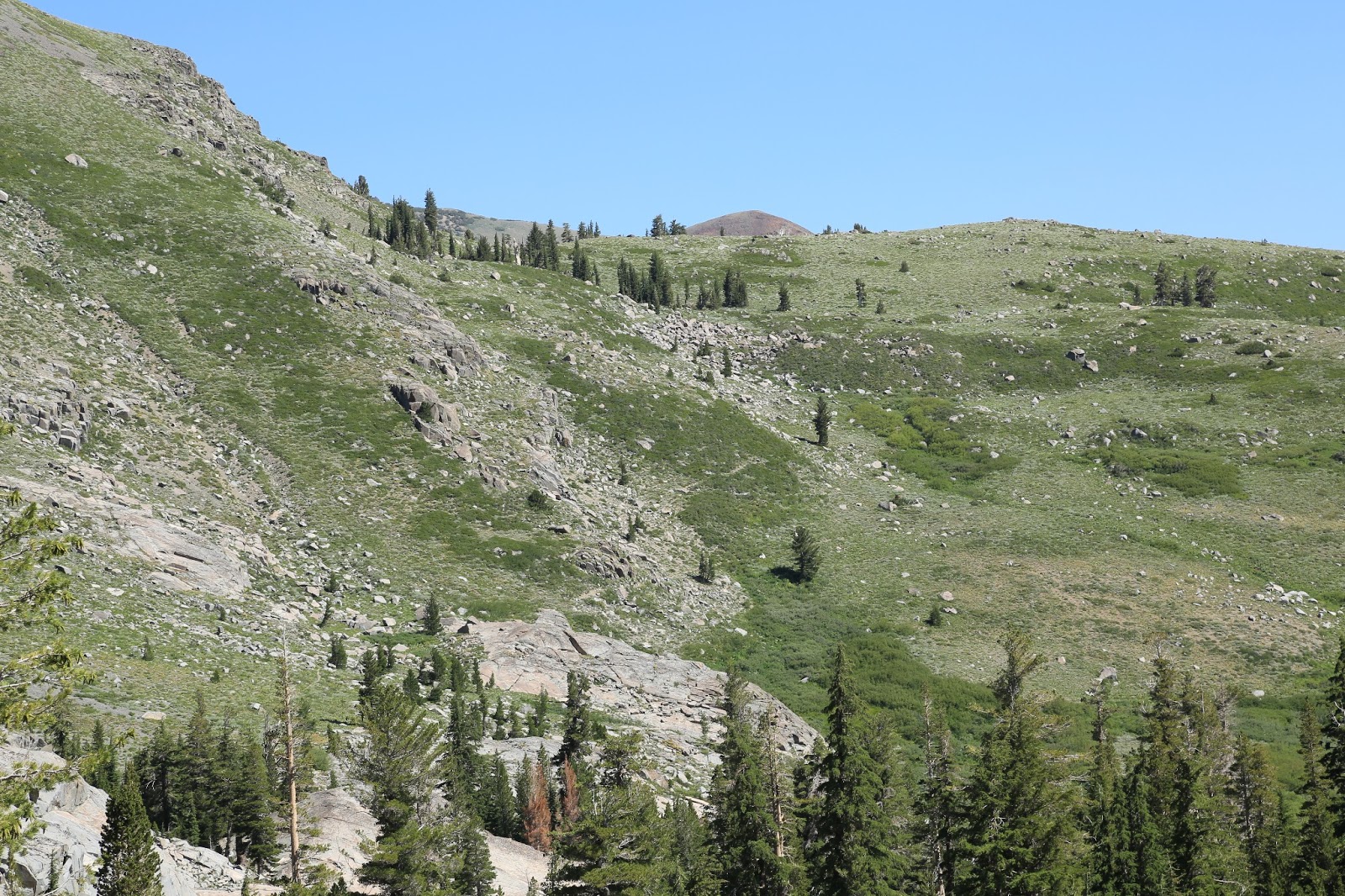
If you look closely you can see the switch backs. It turns out this is a false pass. When I got to the top of this pass, the trail turned back into Elephant's back and continued a steep climb.
Starting the climb up Elephant's back.
It is amazing how these flowers can grow at this elevation!
From this last picture, it was about 45 minutes to the car. A very memorable trip!
Nice work, Eric! I enjoyed the pics and videos....really gives you a sense of the trail. My buddies and I are going on it next week and I'm very much looking forward to it. Thanks!
Great documentation of the hike! My wife and I did it this past weekend as a 2 day hike. The second day seemed to go on forever. Your blog and photos really captured it well and brought it to life!


Nice work, Eric! I enjoyed the pics and videos....really gives you a sense of the trail. My buddies and I are going on it next week and I'm very much looking forward to it. Thanks!
ReplyDeleteGreat documentation of the hike! My wife and I did it this past weekend as a 2 day hike. The second day seemed to go on forever. Your blog and photos really captured it well and brought it to life!
ReplyDelete